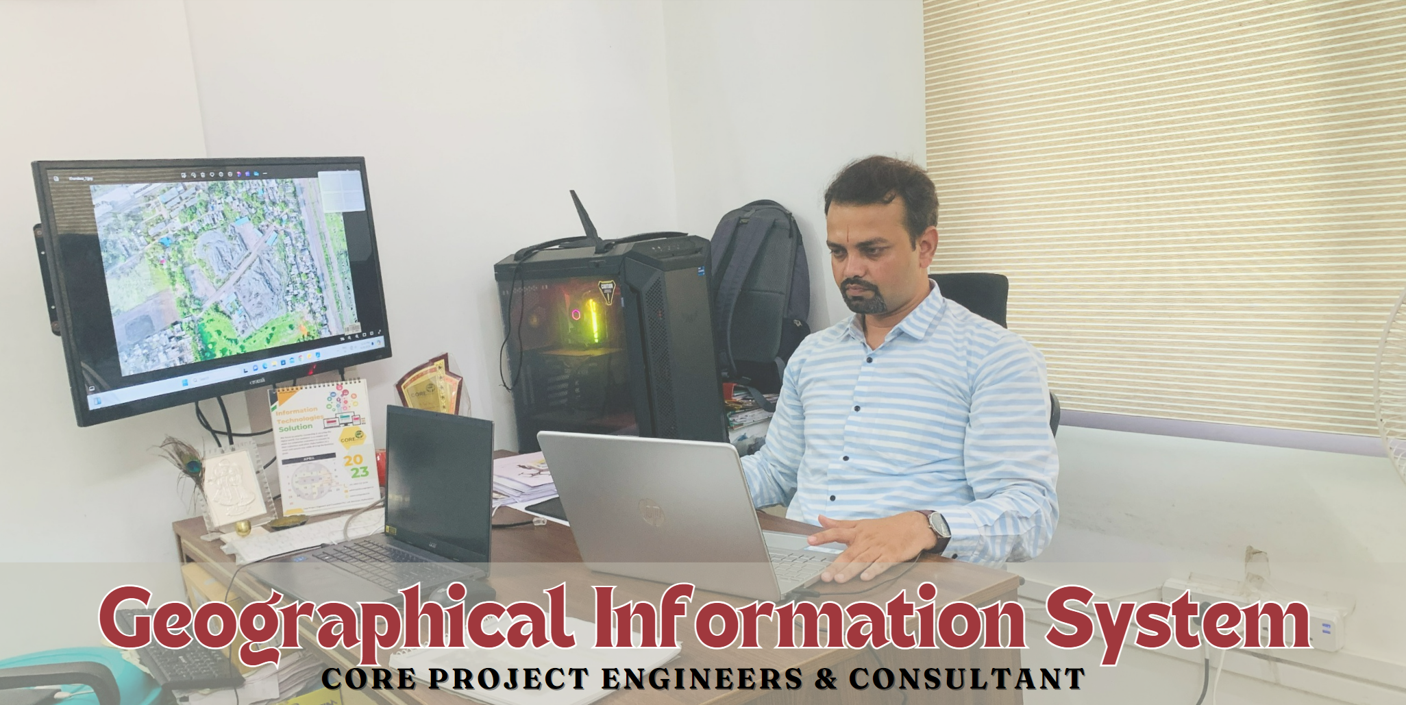
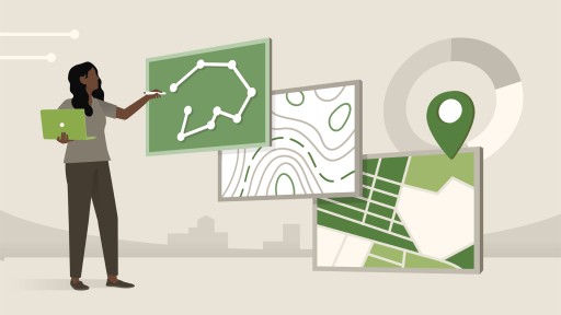
GIS
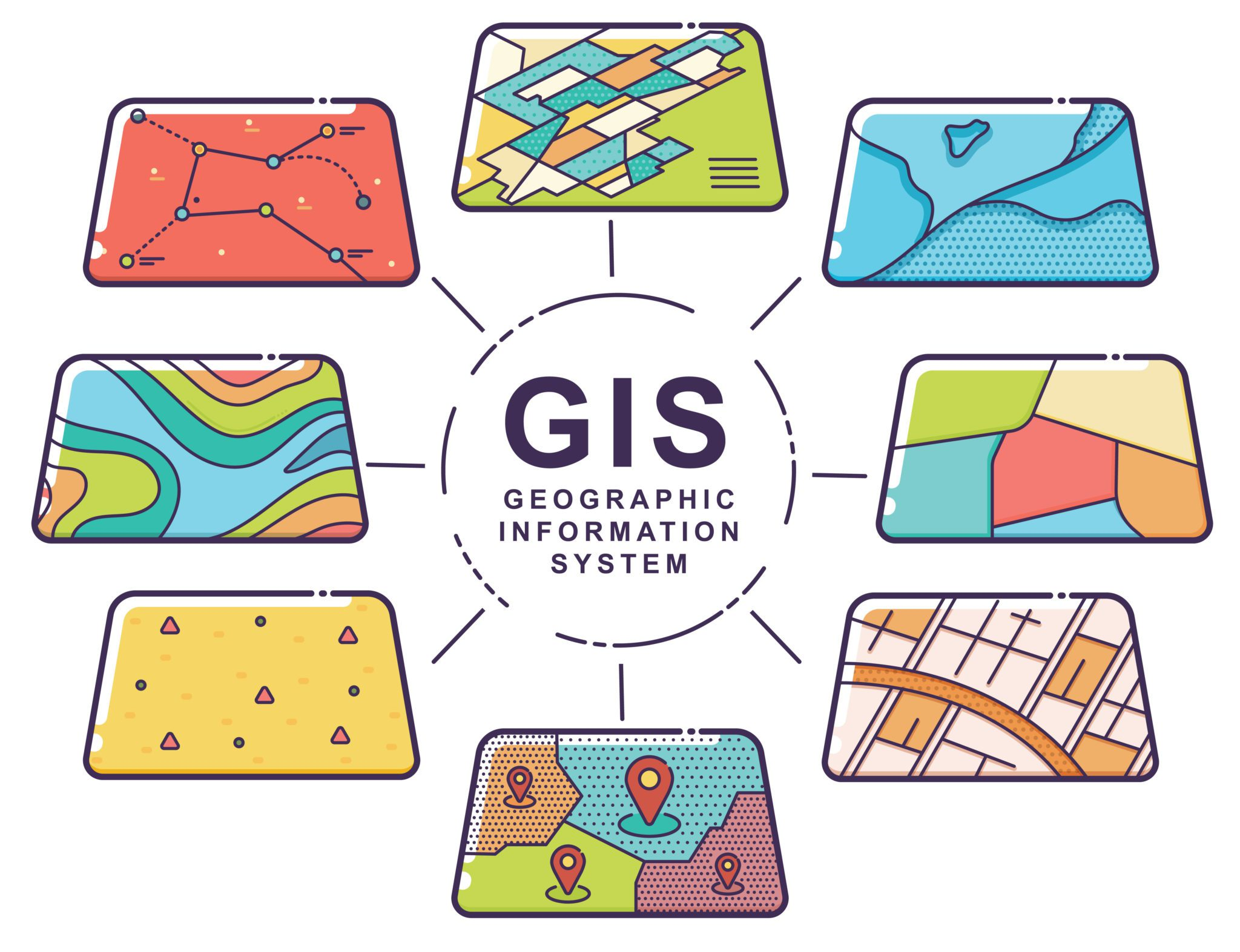
At our company, we specialize in providing comprehensive GIS, drone, and real estate solutions, offering an array of mapping services tailored to meet diverse needs. Our topographic mapping services deliver precise information on elevation, landforms, and terrain, essential for environmental studies, construction, and navigation. Meanwhile, our cadastral mapping focuses on property boundaries and land ownership, aiding in real estate transactions, land administration, and urban planning.
Head of Department - Dr. Kundan Sherekar Sir
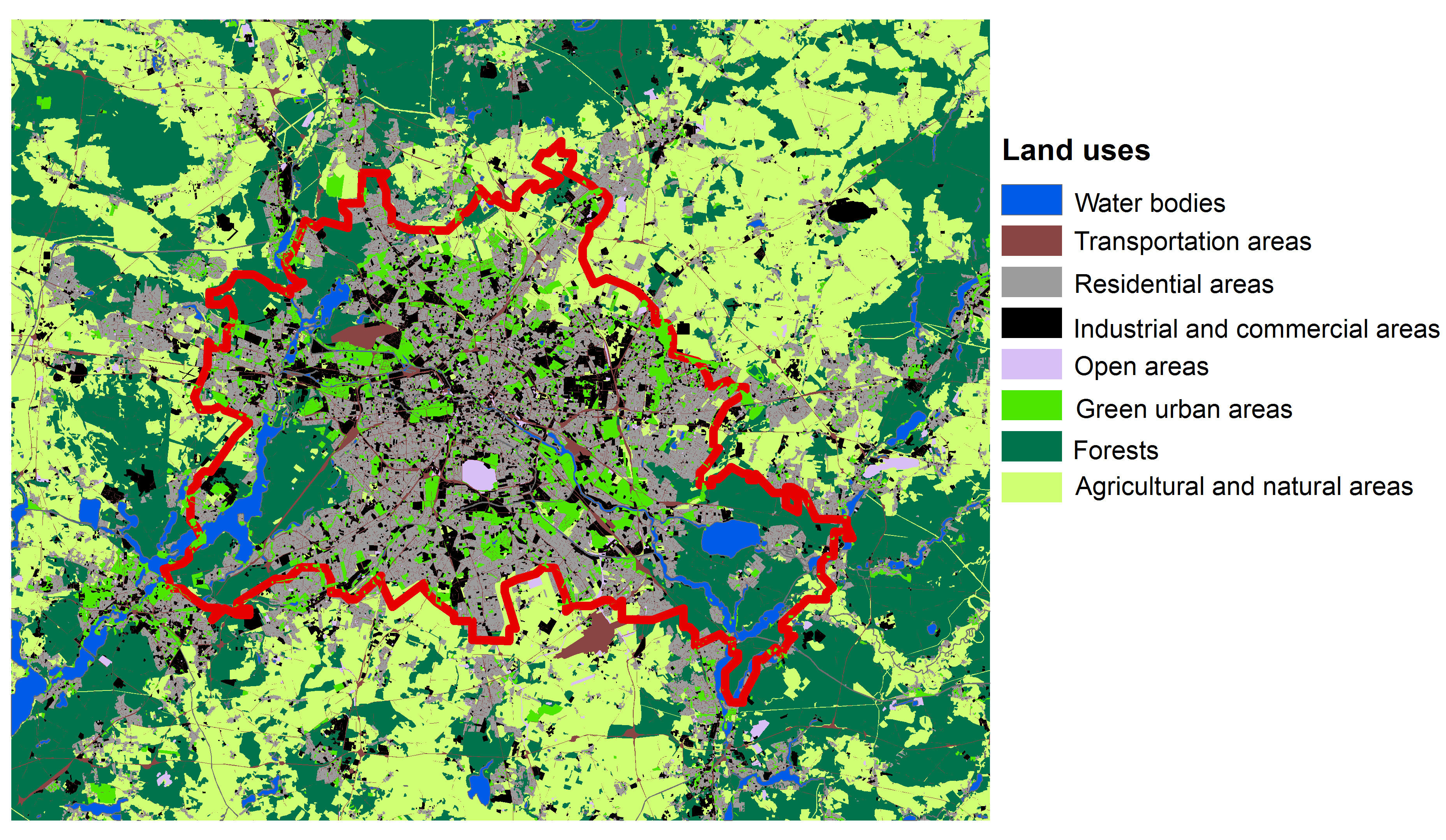
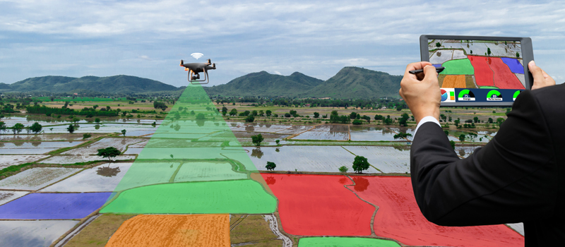
We also excel in thematic and environmental mapping, providing critical insights into population density, land use, climate zones, ecosystems, habitats, and pollution levels. These services are invaluable for demographic studies, resource management, policy-making, environmental monitoring, and conservation efforts. Additionally, our urban planning and zoning mapping assists in sustainable city design and urban growth management, while our utilities mapping enhances infrastructure management for electricity, water, sewage, and gas systems, ensuring efficient maintenance, planning, and emergency response.
Browse Topics
Topographic Mapping
Represents detailed information about the Earth's surface features, including elevation, landforms, and terrain. Essential for environmental studies, construction, and navigation.
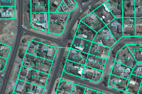
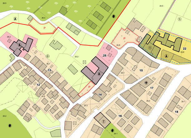
Cadastral Mapping
Focuses on property boundaries, land ownership, and parcel information. Used extensively in real estate, land administration, and urban planning.
Thematic Mapping
Highlights specific themes or subjects, such as population density, land use, or climate zones. Vital for demographic studies, resource management, and policy-making.
Environmental Mapping
Environmental mapping involves mapping ecosystems, habitats, pollution levels, and conservation areas. Crucial for environmental monitoring, conservation efforts, and sustainability planning.
Urban Planning and Zoning Mapping
GIS is mainly used for city planning, infrastructure development, zoning regulations, and land use planning. Helps in designing sustainable cities and managing urban growth.
Utilities Mapping
GIS play a critical role in mapping & managing infrastructure for utilities such as water supply, sewage systems & gaspipelines. GIS helps companies to visualize, analyze, & optimize their networks, maintenance, planning & emergency response.
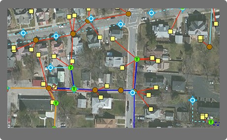
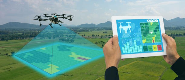
IMAGE CAPTURING
Capture stunning aerial images for maps, surveys, & documentation. Record videos for surveillance of construction sites, traffic flow & events. Offer panoramic views of landscapes & urban areas for comprehensive visualization. Monitor changes over time with timelapse photography, ideal for construction projects & environmental studies.
IMAGE PROCESSING
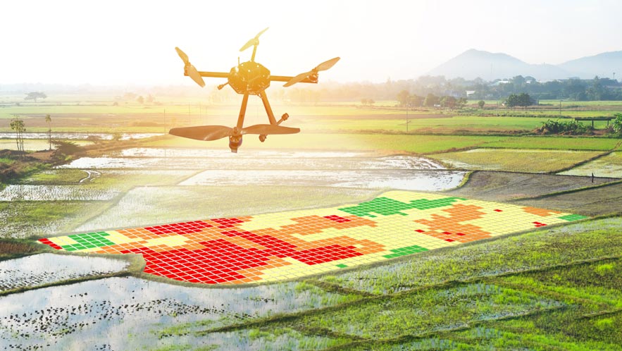
Generate high-resolution maps from overlapping drone images for landscape visualization. Transform drone-captured images into detailed 3D models for planning. Detect heat loss and monitor crop health with thermal imaging. Utilize multispectral images for precise evaluation of vegetation health and environmental conditions.
MUNICIPAL COUNCIL COOPERATIVE WORK
Enhance urban planning and infrastructure projects with precise drone imagery for municipal council cooperative work. Assess roads, bridges, and public buildings with detailed drone inspections. Ensure environmental compliance by monitoring green spaces, water bodies, and air quality.
PRIVATE PROPERTY WORK
Boost property sales with captivating aerial images and videos for real estate marketing on private properties. Conduct accurate boundary mapping, land division, and property valuation with detailed aerial surveys. Optimize farming practices by monitoring crop health, irrigation systems, and soil conditions from above. Enhance security measures with aerial surveillance for large estates, industrial properties, and private events.
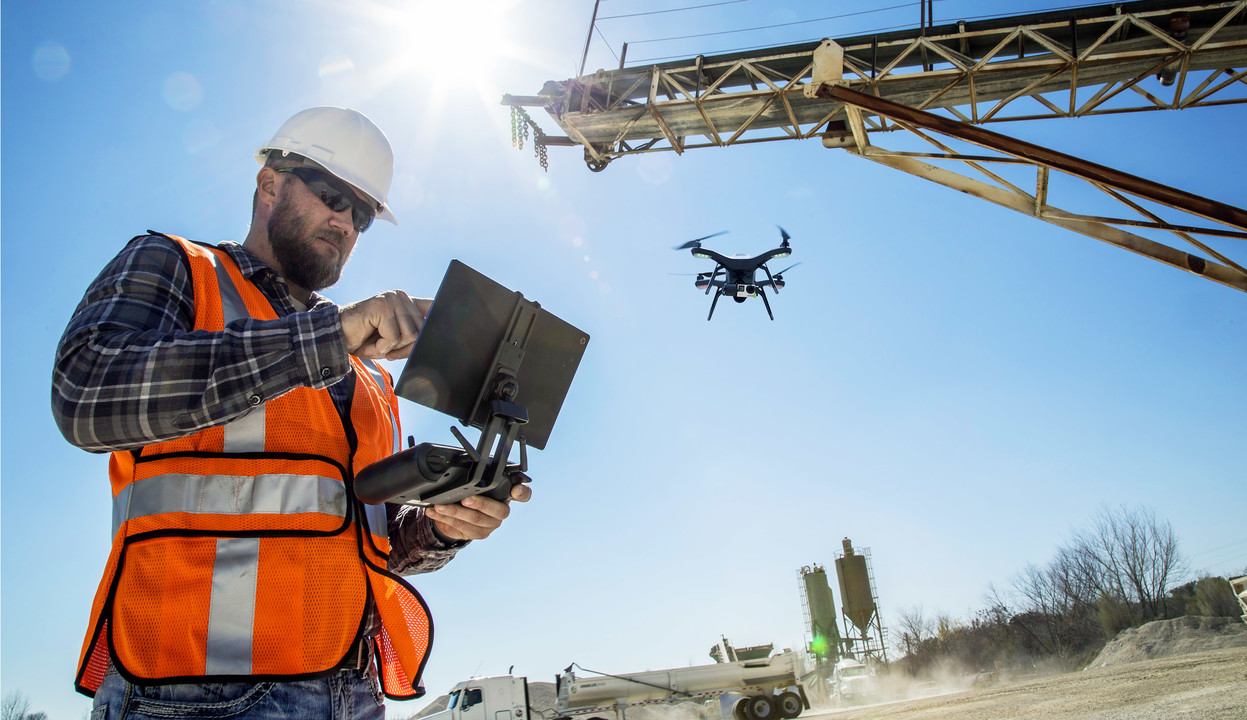
INFRASTRUCTURE DEVELOPMENT
Enhance construction site management with drone technology for infrastructure development, facilitating progress monitoring, resource allocation & safety inspections. Inspecting pipelines, power lines & telecommunications towers for maintenance needs. Utilize drone data for urban planning, transportation, and smart city design. Improve utilities management with drone-enabled inspections, minimizing downtime and enhancing service reliability.

QUALITY CONTROL
Drones can capture high-resolution images and videos of construction work, allowing for detailed inspections of completed structures. This ensures that work meets quality standards and regulatory requirements, minimizing rework and costly errors.

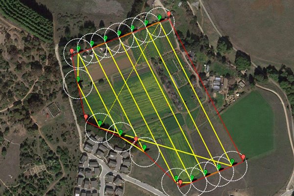
AERIAL SURVEYS & MAPPING
Drones equipped with high-resolution cameras and LiDAR technology can quickly and accurately survey large construction sites, capturing detailed images and data. This information can be used to create 3D maps, topographic models, and digital elevation models, aiding in site planning, design, & analysis.
PROGRESS MONITORING
Drones provide real-time aerial footage of construction progress, allowing project managers to monitor work on-site remotely. This helps in tracking milestones, identifying potential delays, and ensuring that construction stays on schedule.

SITE INSPECTION & SAFETY
Drones can access hard-to-reach or hazardous areas without risking human safety. They can inspect structures, roofs, and other elevated areas for defects, ensuring compliance with safety regulations and identifying potential hazards early on.

GIS Specialization Courses
Map Your World With Geographic Information Systems (GIS). Explore the tools, concepts, and terminology of spatial analysis and modeling. Join this GIS specialization course.
About this (GIS) specialization.
Knowledge of Geographic Information Systems (GIS) is an increasingly sought-after skill in industries from agriculture to public health. This Specialization, offered in partnership with ArcGIS developer Esri, will teach the skills you need to successfully use GIS software in a professional setting.
You will learn how to analyze your spatial data, use cartography techniques to communicate your results in maps, and collaborate with peers in GIS and GIS-dependent fields. In this cource, you will learn a combination of data identification and collection, analytical map development, and spatial analysis techniques.
Skills you will gain
- Geographic Information System (GIS)
- Satellite Imagery Analysis
- Model Building
- Spatial Visualization
- Spatial Analysis
- Data Analysis
- Data Visualization (DataViz)
- Software
- Analytics
- Workflow
- Data Management

Applied Learning Project
Learners will work through the various course projects to gain experience and skills related to geographic information systems. Each course reviews the concepts in a final project to reinforce your learning. Each course builds on the knowledge of the previous and the Specialization culminates with a capstone where you will design and execute a complete GIS-based analysis - from identifying a concept, question, or issue you wish to develop, all the way to final data products and maps that you can add to your portfolio.
There are 5 Courses in this Specialization
- 1. Fundamentals of GIS
- 2. GIS Data Formats, Design and Quality
- 3. Geospatial and Environmental Analysis
- 4. Imagery, Automation, and Applications
- 5. Geospatial Analysis Project
Geographical Information System
Contact us today to learn how our GIS expertise can provide the insights you need to optimize your projects and drive success.

Head of GIS Department
Dr. Kundan Sherekar
Dr. Kundan Sherekar is a seasoned professional with extensive experience in Geographic Information Systems (GIS). He is dedicated to implementing advanced geospatial technologies that enhance data analysis and decision-making. His leadership in the GIS Department ensures that projects meet the highest standards of spatial accuracy and innovation.